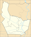
File:Thailand Nonthaburi location map.svg

Size of this PNG preview of this SVG file: 503 × 600 pixels. Other resolutions: 201 × 240 pixels | 403 × 480 pixels | 644 × 768 pixels | 859 × 1,024 pixels | 1,718 × 2,048 pixels | 1,595 × 1,901 pixels.
Original file (SVG file, nominally 1,595 × 1,901 pixels, file size: 536 KB)
File history
Click on a date/time to view the file as it appeared at that time.
| Date/Time | Thumbnail | Dimensions | User | Comment | |
|---|---|---|---|---|---|
| current | 23:27, 17 May 2020 |  | 1,595 × 1,901 (536 KB) | ZeroSixTwo | Uploaded a work by Hdamm for the original map<br>ZeroSixTwo for recolouring from {{Created with Inkscape}} {{AttribSVG|Amphoe Nonthaburi.svg|Hdamm}} with UploadWizard |
File usage
No pages on the English Wikinews link to this file. Pages on other Wikimedia projects are not listed here.
Global file usage
The following other wikis use this file:
- Usage on fr.wikipedia.org
- Usage on id.wikipedia.org
- Usage on th.wikipedia.org
- เทศบาลนครนนทบุรี
- เทศบาลนครปากเกร็ด
- เทศบาลเมืองไทรม้า
- เทศบาลเมืองบางบัวทอง
- เทศบาลเมืองพิมลราช
- เทศบาลเมืองบางศรีเมือง
- เทศบาลเมืองบางกรวย
- รายชื่อโรงเรียนในจังหวัดนนทบุรี
- เทศบาลตำบลบางม่วง
- เทศบาลตำบลบางใหญ่
- เทศบาลตำบลปลายบาง
- ตำบลศาลากลาง
- เทศบาลตำบลไทรน้อย
- เทศบาลตำบลเสาธงหิน
- เทศบาลตำบลบ้านบางม่วง
- ตำบลบางพลับ (อำเภอปากเกร็ด)
- เทศบาลเมืองบางคูรัด
- ตำบลบางตะไนย์
- เทศบาลเมืองบางรักพัฒนา
- เทศบาลเมืองบางแม่นาง
- มอดูล:Location map/data/Thailand Nonthaburi
- ตำบลอ้อมเกร็ด
- เทศบาลเมืองบางกร่าง
- เทศบาลเมืองใหม่บางบัวทอง
- มอดูล:Location map/data/Thailand Nonthaburi/doc