File:Terremoto de Chile de 2010.svg

Size of this PNG preview of this SVG file: 600 × 583 pixels. Other resolutions: 247 × 240 pixels | 494 × 480 pixels | 790 × 768 pixels | 1,054 × 1,024 pixels | 2,108 × 2,048 pixels.
Original file (SVG file, nominally 600 × 583 pixels, file size: 181 KB)
| This free media file is from Wikimedia Commons. Its description page is included below. |
Summary
| Description |
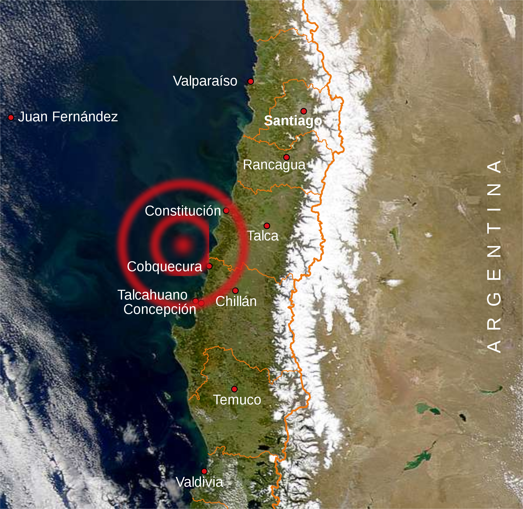
English: Map of the main towns affected by the 2010 Chile earthquake
Español: Mapa con las principales ciudades afectadas por el terremoto de 2010 en Chile. |
| Date | |
| Source | Own work, Central Chile.jpg, Mapa de Chile.svg |
| Author | B1mbo |
Licensing
I, the copyright holder of this work, hereby publish it under the following licenses:

|
Permission is granted to copy, distribute and/or modify this document under the terms of the GNU Free Documentation License, Version 1.2 or any later version published by the Free Software Foundation; with no Invariant Sections, no Front-Cover Texts, and no Back-Cover Texts. A copy of the license is included in the section entitled GNU Free Documentation License. |
This file is licensed under the Creative Commons Attribution-Share Alike 4.0 International, 3.0 Unported, 2.5 Generic, 2.0 Generic and 1.0 Generic license.
- You are free:
- to share – to copy, distribute and transmit the work
- to remix – to adapt the work
- Under the following conditions:
- attribution – You must give appropriate credit, provide a link to the license, and indicate if changes were made. You may do so in any reasonable manner, but not in any way that suggests the licensor endorses you or your use.
- share alike – If you remix, transform, or build upon the material, you must distribute your contributions under the same or compatible license as the original.
You may select the license of your choice.
File history
Click on a date/time to view the file as it appeared at that time.
| Date/Time | Thumbnail | Dimensions | User | Comment | |
|---|---|---|---|---|---|
| current | 20:04, 1 March 2010 | | 600 × 583 (181 KB) | B1mbo | m |
| 20:00, 1 March 2010 |  | 600 × 583 (179 KB) | B1mbo | m | |
| 19:51, 1 March 2010 |  | 600 × 583 (106 KB) | B1mbo | incrusted image | |
| 19:47, 1 March 2010 |  | 600 × 583 (104 KB) | B1mbo | {{Information |Description={{en|1=Map of the main towns affected by the 2010 Chile earthquake}} {{es|1=Mapa con las principales ciudades afectadas por el terremoto de 2010 en Chile.}} |Sourc |
File usage
The following page uses this file:
Global file usage
The following other wikis use this file:
- Usage on es.wikipedia.org
- Usage on fr.wikinews.org
- Usage on id.wikipedia.org
- Usage on nl.wikipedia.org
- Usage on pl.wikipedia.org
- Usage on pt.wikipedia.org
- Usage on qu.wikipedia.org