File:Italy (orthographic projection).svg

Size of this PNG preview of this SVG file: 600 × 600 pixels. Other resolutions: 240 × 240 pixels | 480 × 480 pixels | 768 × 768 pixels | 1,024 × 1,024 pixels | 2,048 × 2,048 pixels | 792 × 792 pixels.
Original file (SVG file, nominally 792 × 792 pixels, file size: 1.79 MB)
| This free media file is from Wikimedia Commons. Its description page is included below. |
Summary
| Description |
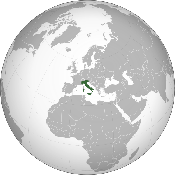
English: Rome-centered orthographic projection map of Italy.
Italiano: Mappa in proiezione ortografica dell’Italia centrata su Roma. |
| Date | |
| Source | Own work using: perlshaper of Gringer |
| Author | Neq00 |
| Other versions |
|
.svg)
This vector image was created with perl.
.svg)
.svg)
.svg)
.svg)
.svg)
.svg)
.svg)
.svg)
.svg)
.svg)
.svg)
.svg)
.svg)
.svg)
.svg)
.svg)
.svg)
.svg)
.svg)
.svg)
.svg)
.svg)
.svg)
.svg)
.svg)
.svg)
.svg)
.svg)
.svg)
.svg)
.svg)
.svg)
.svg)
.svg)
.svg)
.svg)
.svg)
.svg)
.svg)
.svg)
.svg)
.svg)
.svg)
.svg)
.svg)
.svg)
.svg)
.svg)
.svg)
.svg)
.svg)
.svg)
.svg)
.svg)
.svg)
.svg)
.svg)
.svg)
.svg)
.svg)
.svg)
.svg)
.svg)
.svg)
.svg)
.svg)
.svg)
.svg)
.svg)
.svg)
.svg)
.svg)
.svg)
.svg)

.svg)

.svg)

.svg)
.svg)
.svg)
.svg)
.svg)
.svg)
.svg)


.svg)
.svg)
.svg)
.svg)
.svg)
.svg)
.svg)

.svg)
.svg)
.svg)
.svg)
.svg)
.svg)
.svg)
.svg)
.svg)

.svg)
.svg)
.svg)
.svg)
.svg)
.svg)
.svg)
_without_national_boundaries.svg)
.svg)
.svg)
.svg)
.svg)
.svg)
.svg)

.svg)
.svg)
.png)
.svg)
.svg)
.svg)
.svg)

.svg)
.svg)
.svg)
.svg)
.svg)
.svg)
.svg)
.svg)
.svg)
.svg)
.svg)

.svg)
.svg)
.svg)
.svg)
.svg)
.svg)
.svg)
.svg)
.svg)

.svg)
.svg)

.svg)
.svg)
.svg)
.svg)
.svg)
.svg)
.svg)
.svg)
.svg)
.svg)
.svg)
.svg)
.svg)
.svg)
.svg)
.svg)
.svg)
.svg)
.svg)
.svg)
.svg)
.svg)
.svg)
.svg)
.svg)
.svg)
.svg)
_-_Crimea_disputed.svg)
.svg)
.svg)
.svg)
.svg)
.svg)
.svg)
.svg)
.svg)
.svg)
.svg)
.svg)
_political.svg)
.svg)
.svg)
.svg)
.svg)
_-_Crimea_disputed_-_no_borders.svg)
.svg)
.svg)
.svg)
.svg)
.svg)
.svg)
.svg)
.svg)
.svg)
.svg)
.svg)

.svg)
.svg)
.svg)

.png)
.svg)
.svg)
.svg)
.svg)
.svg)
.svg)
.svg)
.svg)
.svg)
.svg)
.svg)
.svg)
.svg)
.svg)
.svg)
.svg)
.svg)
.svg)
.svg)
.svg)
.svg)
.svg)
.svg)
.svg)
.svg)
.svg)
.svg)
.svg)
.svg)
.svg)
.svg)
.svg)
.svg)
.svg)
.png)
.svg)
.svg)
.svg)
_(orthographic_projection).png)
.svg)
File history
Click on a date/time to view the file as it appeared at that time.
| Date/Time | Thumbnail | Dimensions | User | Comment | |
|---|---|---|---|---|---|
| current | 13:24, 29 August 2015 | | 792 × 792 (1.79 MB) | Neq00 | New file. |
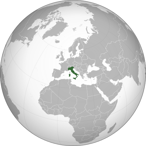
| 15:49, 28 August 2015 |  | 553 × 553 (436 KB) | Neq00 | {{Information |Description ={{en|1=Orthographic projection map of Italy.}} {{it|1=Mappa in proiezione ortografica dell’Italia.}} |Source =Derived from [[:File:Latin Europe (orthographic projection).svg|Latin Europe (orthographic projection... |
File usage
The following 46 pages use this file:
- 5.6-magnitude aftershock earthquake strikes Italy
- Alitalia conditionally accepts joint bid by Air France and KLM
- As Italy prepares for new government, shots fired near prime minister's office
- Berlusconi proposes January elections if government fails to gain parliamentary majority
- Berlusconi to remain in hospital after assault
- Crucifix in Northern Italy collapses, crushing man to death
- Five police officers injured in Naples protest over new garbage tip
- Former Italian Prime Minister Berlusconi found guilty of fraud
- Italian PM Prodi loses confidence vote, resigns
- Italian President Sergio Mattarella re-elected for second term, ending successor row
- Italian ambassador to South Africa dies in accident
- Italian court overturns law preventing trial of Prime Minister Berlusconi
- Italian judge convicts 23 in CIA kidnapping case
- Italian mafia implicated in radioactive waste dumping
- Italian parliament votes to back same-sex civil unions
- Italian police charge homeless local with murder of US exchange student
- Italian police deal strong blow to Mafia network
- Italian police find 24 children living in Rome's sewers
- Italian senate passes €30 billion austerity package
- Italian senate rejects no-confidence vote against minister
- Italy's PM Prodi faces confidence vote
- Italy: Berlusconi announces new government
- Italy: Former PM Silvio Berlusconi dies at age 86
- Italy arrests reputed Mafia boss Lo Piccolo
- Italy initiates €1.5million social media campaign to discourage migrants
- Landslide causes train derailment in Italy; nine dead
- Local municipalities in Italy ask taxes from religious schools
- Lost tomb of 'Gladiator' real life Roman inspiration found
- Mudslides kill at least thirteen in Italy
- Political scandal in Italy: reported interference on major media
- Prime Minister of Italy Silvio Berlusconi assaulted
- Rail explosion reported at Viareggio, Italy
- Rubens Barrichello wins 2009 Italian Grand Prix
- Scientist says he predicted Italy earthquake, was ignored
- Sebastian Vettel takes pole for 2008 Italian Grand Prix
- Sebastian Vettel wins 2008 Italian Grand Prix
- Silvio Berlusconi convicted of sex with underage prostitute
- Subject of high-profile Italian euthanasia case dies
- Two embassies in Rome, Italy hit by bomb attack
- Venice hotel sells rooms for one cent a night after pricing error
- Wikinews interviews Corrado Giustozzi, security consultant and author
- User:Samuel Kirwin/Volcano on Italy's island of Stromboli erupts in massive explosion
- Wikinews:Template messages/Infoboxes/Countries
- Template:Infobox/lookup/Italy
- Template:Italy
- Category:Italy
Global file usage
The following other wikis use this file:
- Usage on ar.wikipedia.org
- Usage on en.wikipedia.org
- Usage on en.wikibooks.org
- Usage on es.wikipedia.org
- Usage on incubator.wikimedia.org
- Usage on it.wikipedia.org
- Usage on it.wikibooks.org
- Usage on it.wikiversity.org
- Usage on ky.wikipedia.org
- Usage on pms.wikipedia.org
- Usage on pt.wikipedia.org
- Usage on sr.wikipedia.org
- Usage on to.wikipedia.org
.svg)