File:Ice Map NASA March 9 2008.jpg
Size of this preview: 424 × 600 pixels. Other resolutions: 169 × 240 pixels | 339 × 480 pixels | 543 × 768 pixels | 723 × 1,024 pixels | 2,479 × 3,508 pixels.
Original file (2,479 × 3,508 pixels, file size: 1 MB, MIME type: image/jpeg)
| This free media file is from Wikimedia Commons. Its description page is included below. |
Summary
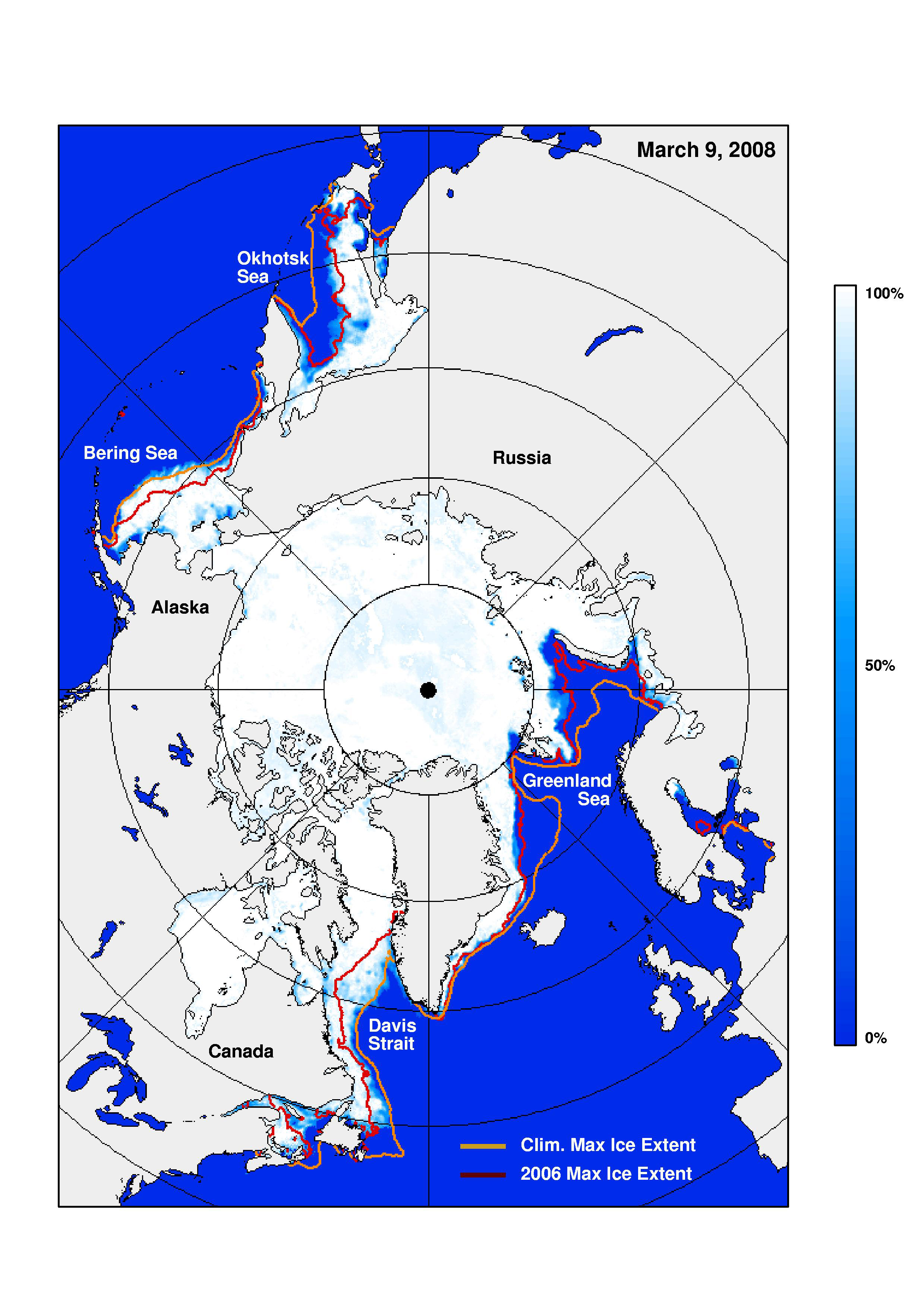
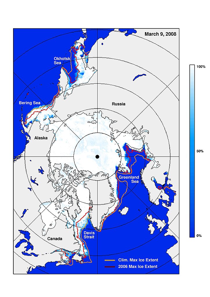
| Description | This ice concentration map dated March 9, 2008, indicates maximum ice extent in the Northern Hemisphere and the contour of the ice edge in 2006 (when the maximum extent was least extensive during the satellite era) is shown in red while that for the 28-year average is shown in gold. | |||||
| Date | Uploaded: March 18, 2008; Taken: March 9, 2008 | |||||
| Source | http://www.nasa.gov/topics/earth/features/seaice_conditions_media.html | |||||
| Author | NASA | |||||
| Permission (Reusing this file) |
|

File history
Click on a date/time to view the file as it appeared at that time.
| Date/Time | Thumbnail | Dimensions | User | Comment | |
|---|---|---|---|---|---|
| current | 21:07, 18 March 2008 | | 2,479 × 3,508 (1 MB) | DragonFire1024 | {{Information |Description=This ice concentration map dated March 9, 2008, indicates maximum ice extent in the Northern Hemisphere and the contour of the ice edge in 2006 (when the maximum extent was least extensive during the satellite era) is shown in r |
File usage
The following page uses this file:
Global file usage
The following other wikis use this file:
- Usage on en.wikipedia.org