File:Africa-countries-central.png
No higher resolution available.
Africa-countries-central.png (360 × 392 pixels, file size: 10 KB, MIME type: image/png)
| This free media file is from Wikimedia Commons. Its description page is included below. |

|
File:Africa-countries-central.svg is a vector version of this file. It should be used in place of this PNG file when not inferior.
File:Africa-countries-central.png → File:Africa-countries-central.svg
For more information, see Help:SVG. |
 |
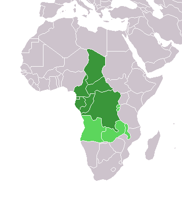
Map of countries in Central Africa.
This map was made by w:User:Joy and originally uploaded to the English Wikipedia as Africa-central-countries.png at 01:32, 28 March 2004. It is a modification of Image:BlankMap-World.png.

|
Permission is granted to copy, distribute and/or modify this document under the terms of the GNU Free Documentation License, Version 1.2 or any later version published by the Free Software Foundation; with no Invariant Sections, no Front-Cover Texts, and no Back-Cover Texts. A copy of the license is included in the section entitled GNU Free Documentation License. |
| This file is licensed under the Creative Commons Attribution-Share Alike 3.0 Unported license. | ||
| ||
| This licensing tag was added to this file as part of the GFDL licensing update. |
File history
Click on a date/time to view the file as it appeared at that time.
| Date/Time | Thumbnail | Dimensions | User | Comment | |
|---|---|---|---|---|---|
| current | 18:21, 17 March 2018 | | 360 × 392 (10 KB) | Maphobbyist | Montenegro border |
| 18:06, 13 January 2014 |  | 360 × 392 (10 KB) | VVVF | Some corrections | |
| 19:52, 9 July 2011 |  | 360 × 392 (13 KB) | Maphobbyist | South Sudan has become independent on July 9, 2011. Sudan and South Sudan are shown with the new international border between them. | |
| 11:10, 5 May 2006 |  | 360 × 392 (4 KB) | Hautala | optimized with png | |
| 18:30, 29 April 2005 |  | 360 × 392 (14 KB) | ChongDae | from en:Image:Africa-countries-central.png {{GFDL}} Category:Maps of Africa |
File usage
No pages on the English Wikinews link to this file. Pages on other Wikimedia projects are not listed here.
Global file usage
The following other wikis use this file:
- Usage on fr.wikipedia.org
- Usage on he.wikipedia.org
- Usage on ht.wikipedia.org
- Usage on incubator.wikimedia.org
- Usage on is.wikipedia.org
- Usage on is.wiktionary.org
- Usage on kaa.wikipedia.org
- Usage on kbd.wikipedia.org
- Usage on ko.wikipedia.org
- Usage on ky.wikipedia.org
- Usage on mg.wikipedia.org
- Usage on nl.wikipedia.org
- Usage on nn.wikipedia.org
- Usage on oc.wikipedia.org
- Usage on pl.wikipedia.org
- Usage on ru.wikipedia.org
- Usage on sl.wikipedia.org
- Usage on sv.wikipedia.org
- Usage on sv.wikinews.org
- Usage on szl.wikipedia.org
- Usage on tk.wikipedia.org
- Usage on tt.wikipedia.org
- Usage on uk.wikipedia.org
- Usage on uz.wikipedia.org
- Usage on wo.wikipedia.org
- Usage on yi.wikipedia.org